Welcome to the Kilbeggan to Mullingar Greenway Project
The Project
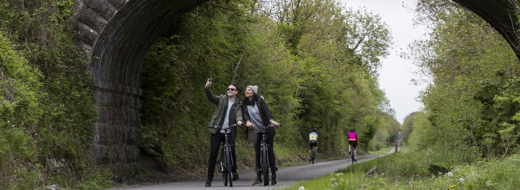
Westmeath County Council in conjunction with Transport Infrastructure Ireland (TII) intends to deliver a greenway from Kilbeggan to Mullingar. This section of greenway will complete a strategic link between the established greenway infrastructure on the Grand Canal Greenway (linking Kilbeggan with Tullamore) and the Old Rail Trail/ Royal Canal Greenways (linking Mullingar with Athlone, Dublin, and Longford). This will provide a high-quality greenway, designed to promote cycling, walking and other non-motorised travel.
In 2023, WCC appointed Tetra Tech | RPS to deliver the Kilbeggan to Mullingar Greenway Project through Phases 1 to 4 of the TII Project Management Guidelines.
Progress to Date
In Phase 1 (Concept and Feasibility), the first non-statutory public consultation for the Kilbeggan to Mullingar Greenway Project was held in May 2023 and displayed the study area for the project. Feedback from the first public consultation helped inform the identification of areas of interest and constraints, which in turn informed the development of route corridor options within which a route for the greenway could be developed.
In Phase 2 (Options Selection), two feasible route corridor options were identified to connect tourism and leisure attractions and use publicly owned land where possible. Both route corridor options start in Kilbeggan Harbour and end in Mullingar with one corridor to the west of Lough Ennell and one corridor to the east of Lough Ennell.
A second public consultation was held in May 2024 where the two route corridor options were displayed. Feedback from the second public consultation helped inform the appraisal process of the route corridor options. Other factors that were considered in the appraisal included the project objectives, the locations of attractions within the corridors, and environmental constraints.
Following the completion of the Options Selection appraisal for the Kilbeggan to Mullingar Greenway a third public consultation was held from 16th June through 25th July 2025 to update all stakeholders, landowners, members of the public and interested parties on project progress. The Emerging Preferred Route Corridor (EPRC) which was developed matching the best performing segments of the two route corridor options was displayed.
Submissions and feedback received during Public Consultation No.3 were collated and assessed as part of the process to select the Preferred Option corridor which is available to view below.
The area represented by the Preferred Option corridor does not represent the extent of lands required for the provision of the project; instead, it indicates the lands within which the project could be feasibly developed.
What's Happening Now
The Preferred Option corridor map is now available to view below. It is also published along with the Options Selection Report on the ‘Downloads’ tab. The next phase of TII’s planning and design process, Phase 3 – Design and Environmental Evaluation is progressing to identify a route within the Preferred Option Corridoor. This involves developing the project design based on both technical and environmental inputs, to a stage where sufficient levels of detail exist to establish landtake requirements, to identify and mitigate project impacts, and to progress the project through the statutory processes.
Throughout the Phase 3 process, the Project Team is committed to continuously engaging with people living, working or who own land and property within the Preferred Option corridor, however the design of the greenway and identification of the impacts on land and property will take some time to develop.
In order to inform the design process, the Project Team is undertaking a range of engineering and environmental site surveys. The design team will be in contact with relevant landowners to arrange these surveys.
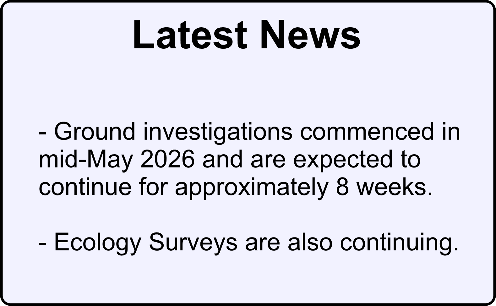
As the site surveys are completed, the preliminary design and environmental evaluation of the greenway can be progressed. When the design has reached a level of maturity where informed discussions can take place, the Project Team will consult with directly impacted landowners in relation to the initial design and its impact on land and property. Thereafter, feedback will be considered, and amendments may be made, where feasible, before finalising the design. Ground investigations commenced in mid-May 2026, throughout the Preferred Option Corridoor, and are expected to continue for approximately 8 weeks. Ecology Surveys are also continuing.
Public Consultation No. 3 Emerging Preferred Route Corridor
The consultation period for Public Consultation No. 3 Emerging Preferred Route Corridor closed on 25th July 2025.
Details shown during the consultation including maps and project information are still available to view in the virtual consultation platform at the link below.